The most interesting in the mountain hike along the Pamir-Alay, the Kichik-Alay ridge:
- The hike will be officially registered, each participant fulfills the standard for assigning the 3rd category in sports tourism, will receive a certificate of passage of the route and the “Tourist of Russia” badge;
- Opportunity to see the Pamirs and Lenin Peak (7134 meters);
- Climbing the five-thousander Skobelev Peak (5051 meters);
- Passage of 4 mountain passes with a height of 4000 meters, various forms of mountain relief;
- Huge color variety of landscapes, numerous lakes, alpine meadows with grazing yaks;
- A logical linear route that completely crosses the Kichik-Alai ridge from south to north and ends in the northern spurs of the ridge, which are strongly dissected, and for this reason chosen by climbers.

This route will be interesting for tourists who have seen a lot and want more. For this route it is desirable to have hiking experience. It is supposed to pass technical obstacles, move in bundles along the glacier, various scree slopes of different steepness.
The route begins in the vast Alai Valley, located at an altitude of more than 3,000 meters and is very dry. Then it is planned to climb the five-thousander, to the peak of Skobelev 5,051 meters. Climbing it from the south is quite simple (1B category of difficulty). Next, it is planned to visit (with a day) the picturesque cascade of Damdzhailo lakes, located at an altitude above 4,000 meters. Visiting the picturesque valley of the Kichik-Alai river, with grazing yaks. Some people compare the valley of the Kara-Sel River with the famous Grand Canyon for the similarity of landscapes.


* An additional discount on paying for a mountain hike in the Pamir-Alay is provided to tourists who have previously traveled with the Sputnik sports travel club!
Why choose us?
The hike will be registered with the Route Qualification Commission. At the end, each participant receives a certificate of passage of the route, the badge "Tourist of Russia" and a certificate for it.
The route has been repeatedly successfully completed by our club, all organizational details have been checked and worked out to the smallest detail.
If you are a group of 8 people, we will conduct this trip on dates convenient for you.
We provide you with quality equipment at a reasonable price. Have the opportunity
travel light and save a lot of money.
Great hike
A personal manager will advise you at all stages of preparation, help you get ready for a trip, give recommendations on buying tickets and equipment.
Fill out the application and closer to the start make a small advance payment (from 10%) in the most convenient way for you. The rest of the amount - on the day of the start.
Reliability
Our tourist club is officially registered, concludes contracts, pays taxes. There are experienced instructors on the routes. Only modern and high-quality equipment is used.
Those who go hiking with our tourist club for the second or more time receive a 5% discount on participation.
1. Itinerary and requirements 2. Travel plan 3. Cost of participation 4. Recommendations for equipment
Route:

Osh city - Kashka-Su village (Alai Valley) - Kashka-Su river - Kekdzhar river - Skobelev Saddle pass - Skobelev peak (1B, 5,051 meters) - Damdzhailo lake - Kyzylkur pass (1A, 4,500 meters) - Tyuz-pass Ashu (1A, 4273 meters) - Tyuz river - Kichik-Alai river - Kara-Sel river - Kichik-Alai pass (n / a, 4082 meters) - descent along the Kichik-Alai river - Osh city.
Required documents: Enough passport of the Russian Federation (a foreign passport for citizens of the Russian Federation on the territory of Kyrgyzstan is not required)
Requirements for the physical preparation of participants: Hiking experience required, good physical shape

Participation rules and safety precautions when making a mountain hike in the Pamir-Alay
1 day
Meeting of the group in the city of Osh (in the south of Kyrgyzstan). We are located in a guest house, 30 minutes drive from the airport. Getting to know the group. Walk around the city. Those who wish can take a walk to Mount Suleiman, located in the very center of the city, from the top of which the city of Osh is in the palm of your hand. We buy food and gas for the trip.


2 day
In the morning departure on a custom vehicle. Transfer of the group to the Alai valley, the path passes through the Taldyk automobile pass, with a height of over 3,600 meters. Further descent to Alai valley. In the afternoon we arrive at the southern spurs of the Kichik-Alai ridge, distribute food and equipment. We spend the night on the banks of the Kashka-Su river. From the south you can see the powerful Pamir. Dinner here and then we cook on gas burners.


3 day
The active part of the route begins. We move through endless onion fields. Climbing up the Kashka-Su valley. Behind there is a great view of the Pamirs and Lenin Peak. The Zaalai Range frames the Alai Valley from the south. Overnight in the upper reaches of the river.


Day 4
We continue to climb in the morning. Trek to the mouth of the Kekdzhar River. Smooth gradual climb. Yaks and horses graze in places. Endless alpine meadows. From here, the next day, a 2-day ascent to Skobelev Peak (light) will begin. Then the descent back to the makeshift Base Camp.


Day 5
We take with us food for 2 days and go out to storm the Skobelev peak. The ascent will take 2 days: a day approaching the summit, the second day an assault and a return descent to the mouth of the Kekdzhar River. In the first half of the day, climbing along the Kekdzhar River, then going to the moraine ramparts. Ascent to the side moraine of the glacier. Overnight at about 4500 meters.


Day 6
Then climb up the open glacier. Climbing is best done in the morning, while the glacier is “not limp” and movement on it is safer. In the upper part of the glacier is closed, we go in bundles. possible cracks in the glacier. Movement in cats. Climbing the scree slope to the Sedlo Skobelev pass and further to the very top of Skobelev 5,051 meters, which received its name in the 19th century in honor of the talented Russian commander Mikhail Dmitrievich Skobelev, the hero of Plevna and Shipka, the liberator of Bulgaria from Turkish oppression and a supporter of strengthening Russia and rapprochement of the Slavs . Skobelev Peak is the highest point of the Kichik-Alai ridge. Descent along the path of ascent to the camp on the side moraine. Late lunch and descent back to the left things in the Kekjar river valley.


Day 7
Trek to the cascade of Damdzhailo lakes. On the way we make a stop for lunch. On one of the picturesque lakes we stop for the night.


Day 8
Day in a picturesque place. Also, this day is a reserve in case of bad weather on previous days.


Day 9
After a day of rest, you will have to climb the not difficult Kyzylkur pass (1A, 4,500 meters), however, there will be a decent climb. Further descent to the river of the same name, approach to the next pass.


Day 10
Plan for the 10th day: Tyuz-Ashu pass (1A, 4273 meters) - Tyuz river - Kichik-Alai river.


Day 11
Gradual climb along the Kichik-Alai river, then exit to the valley of the Kara-Sel river and up along it. The river valley is compared with the famous Grand Canyon - one of the deepest canyons in the world, for the similarity of landscapes.


day 12
Kara-Sel river - Kichik-Alai pass (n / a, 4082 meters) - descent along the Kichik-Alai river. This pass is one of the easiest on the route. Yaks graze on its slopes.


day 13
Further descent along the wide valley of the Kichik-Alai river. Numerous yaks grazing can be seen in the valley. In places yurts with local shepherds. We pass by shepherds living in yurts to a small village. Then departure to the city of Osh. The journey takes several hours. Accommodation in a guest house, where dinner, shower and clean clothes are waiting for us.


Day 14
Departure of participants to their homes
The itinerary or route schedule can be adjusted on the spot, based on weather conditions, group readiness and other circumstances.
Program cost: 29 900 rub.
Included in the price:
- Accommodation in Osh city (in the city center) before and after the route (2 nights)
- Transfer to the mountains and back from the city of Osh (by car)
- Meals on the route (we cook ourselves on the burners), breakfast in the city of Osh on the second day;
- Group equipment (gas, burner, pharmacy)
- Instructor
Price does NOT include:
- Flight to the city of Osh and back (there is regular air communication with Moscow, Yekaterinburg, Novosibirsk and other major cities of the Russian Federation, and you can also get there with a transfer in Bishkek).
- Meals while traveling by car (stops at roadside cafes), while staying in the city of Osh (except breakfast on the 2nd day);
- Other expenses not covered by the program;
135 years ago, in July-August 1876, the so-called Alai campaign took place, which ended with the annexation of the southern part of modern Kyrgyzstan to the Russian Empire. In his report dated October 23, 1876 to the commander of the troops of the Turkestan military district, the commander of the Alai detachment, Major General Mikhail Dmitrievich Skobelev, in the future the famous Russian commander, the famous "white general", reporting on the results of his "military-scientific" expedition, wrote: “The Karakirghiz, who inhabit the mountainous strip, were brought into obedience, a Russian government was established between them ... From now on, these nomads, who did not recognize anyone's power, are Russian subjects. Our position on the Kashgar border was revealed. Misunderstandings with the Caratigen are over. Countries completely unknown to Europeans have been discovered, and about 25 thousand square miles have been mapped..
The Alai campaign fully reflected the “voluntary-compulsory” nature of the accession of Central Asia to the Russian Empire - where possible, the imperial authorities tried to avoid the use of force, acting mainly with the help of a “carrot”, that is, trying to convince the population future colonial possessions in the immeasurable benefits of being in the sphere of Russian influence.
But from the mid-60s of the XIX century, a much more “hard” line prevailed: as soon as the achievement of the main goal - the establishment of complete Russian domination - met even the slightest resistance, severe blows fell on the “rebellious” in order to explain to the “unreasonable natives” all the senselessness of resistance .
And it must be admitted that in the end, such tactics, based, of course, primarily on the huge military superiority of Russia, worked - gradually more and more representatives of the local elite were forced to recognize the inevitability and even "goodness" of the transition of their peoples under the rule of the Russian crown .
This, in particular, is evidenced by the life path of such a bright and unique historical figure as Kurmanzhan-Datka (1811–1907), nicknamed the “Queen of Alai”.
"Queen of Alai"
After the capture of Tashkent by Russian troops (1865), only the Ferghana Valley remained in direct subordination to the Kokand khans. True, purely formally, the sovereignty of Kokand extended to the mountainous regions of southern Kyrgyzstan - the Alai Valley. However, the militant nomadic population of these regions (in Russia they were called "Karakirghiz" and "Kipchaks") essentially never submitted to Kokand. Moreover, quite often they raided the flat Kokand lands.
Kokand regularly sent troops against the Alai, but each time these punitive expeditions failed, running into the most stubborn resistance of the highlanders. In the end, the Kokand khans were forced to come to terms with the real independence of the mountainous region and, in fact, recognize the peculiar patriarchal state that had developed here, headed by a woman ruler - a situation that is rare for the Islamic East!
This woman's name was Kurmanzhan. She was born in the family of a simple nomad from the Mongush clan. At the age of 18, she was given in marriage to a man whom she first saw on her wedding day. She did not like him, and, contrary to custom, she did not go to her husband, but remained in her father's Yurt. In 1832, the Alai feudal lord Alimbek, who received the title of “datka” (ruler) of all the Kirghiz of Alai from the Kokand Khan, freed her from the marriage agreement and married her himself. Due to the frequent absence of her husband (he became close to the Kokand Khan, and then the first vizier), Kurmanjan, in fact, ruled Alay. After the death of Alimbek, who fell victim to a palace conspiracy in Kokand (1862), she openly took power into her own hands.
However, the Kokand Khan Khudoyar declared the Alai Kirghiz his subjects and imposed taxes on them, which was completely unacceptable for the nomads, who never paid anything to anyone. Kurmanzhan opposed this and, as a result of a stubborn struggle, she achieved success. First, it was recognized by the Emir of Bukhara Muzaffar, and then by Khudoyar Khan himself. She was given the honorary title of Datka "with proper label and gifts". She became the only woman who was honored with a solemn reception in the palace of the Emir of Bukhara.
Kurmanjan-Datka very quickly acquired a reputation as the wisest ruler, successfully settled the tribal disputes of the mountainous Kyrgyz, and pursued a policy independent of the Kokand Khanate. This outstanding woman perfectly understood the significance of the Great Silk Road and organized something like a customs: first, sending her people towards the caravan to intimidate, and then, when the merchants turned to her as a ruler for help and protection, Kurmanzhan named her price of safe passage travelers. She was assisted by her sons - Abdullabek, Mamytbek, Kamchibek and Asanbek, as well as her nephew Mirza-Payas. Each of them controlled a part of the Kirghiz nomad camps in Alai.
The collapse of the Kokand kingdom
Meanwhile, a social explosion was brewing in the Kokand Khanate itself. The loss of territories occupied by Russian troops caused a reduction in treasury revenues, which prompted Khan Khudoyar to increase taxes on the remaining population. The collection of taxes was accompanied by monstrous arbitrariness, which turned the "financial policy" of the khan's authorities into outright robbery. In addition, the endless bloody tribal and palace civil strife did not stop, ruining the economy of the region and taking away many human lives.
All this, in the end, led to a popular uprising (1873) against Khan Khudoyar in the southeast of Kokand, and then throughout the Ferghana Valley. The main driving force of the uprising was the social lower classes - nomadic Kyrgyz and Uzbek farmers.
Interestingly, a significant part of the rebels saw Russia as their protector from the khan's violence. Even at the beginning of the uprising, in November 1873, a deputation of the Kokand Kirghiz presented the Russian administration of the Turkestan Territory with a list of 42 Kirghiz clans, whose members expressed a desire to accept Russian citizenship. In the spring of 1874, a group of rebels led by the Kirghiz Mamyr turned to the Governor-General of Turkestan Konstantin Petrovich Kaufman with a request to accept them into Russian citizenship.
In April of the same year, the rebellious Kyrgyz, whose number was, according to their own calculation, more than 200 thousand, in a letter addressed to the Russian citizen Zhurabek (who was on close terms with Kaufman and spoke Russian), asked him to petition for their acceptance into Russian citizenship. .
The rebels, in particular, wrote: “As you know, all the Kyrgyz subordinate to Kokand are considered subjects of Khudoyar Khan. Oppression, persecution, terrible executions, somehow impalement, which we are subjected to by the khan, and punishment with sticks, forced us to fall away from the khan and take a hostile position in relation to his family ... If there is an opportunity and it will not be difficult for you, report about all of the above to the Governor General. With the consent of His Excellency, we, the unfortunate subjects of Kokand, could get rid of the tyranny of Khudoyar Khan and find peace..
When Mullah Iskhak Khasan-uulu (born Kirghiz from the Boston tribe) became the leader of the rebels, calling himself Pulatkhan, the grandson of the late Kokand Khan Alim, he also tried to establish ties with the Turkestan colonial administration and sent his envoys to the governor-general. However, the Russian authorities arrested his delegation.
So in vain did the rebels expect support from Russia. According to the agreement of 1868, St. Petersburg undertook to provide assistance to the "legitimate power", and as such, he recognized first Khan Khudoyar, and then his heir Nasreddin. Since the autumn of 1875, the Russian administration began to openly defend the Kokand Khan, sending troops to help him. Until recently, the "natives" who asked for Russian citizenship followed the progress of the Russian troops with bewilderment.
Kurmanzhan Datka initially sympathized with the rebels and, in general, sympathized with their appeals for help to Russia. However, after the decisive intervention of Russian troops in Kokand affairs, the “Alai queen” changed her attitude towards Russian politics, without preventing her eldest son Abdullabek from becoming one of the most active allies of the “Kyrgyz Pugachev” - the false Pulatkhan.
The latter declared a ghazavat (holy war) to Russia, and the rebels began to attack more and more often not only Russian soldiers in the Kokand Khanate itself, but also invaded the boundaries of the governor-general. So, for example, one of the detachments went to the Tashkent-Khodzhent tract, where he began to burn postal stations, capturing coachmen and passers-by.
And in general, the uprising began to acquire an openly anti-Russian character. The cruelties committed by the Russian troops during the suppression of the uprising were "balanced" by all kinds of atrocities against Russian prisoners of war and settlers.
However, the Russian intervention did not save the Kokand khans: in July 1875, when the rebel detachments approached Kokand, Khudoyarkhan, betrayed by his own army, fled under the protection of the Russian authorities. In October, the same fate befell his son and heir, Nasreddin. The rebels led by "Pulatkhan" captured Namangan, and the Russian garrison, hiding in the citadel, was barely able to repulse the assault. In response, new Russian troops were transferred to the Namangan region, led by the then Colonel Skobelev. His Namangan detachment began to make desperate raids into various regions of the khanate, crushing the rebels everywhere.
"Pulatkhan" tried to resist the offensive of the tsarist troops, but was defeated near Andijan and near Asaka. Departing with five thousand soldiers to Uch-Korgon, he was overtaken by a detachment of Baron Meller-Zakomelsky, who unexpectedly attacked the rebel camp. "Pulatkhan", however, managed to escape to Alay. Meller-Zakomelsky's detachment followed in his footsteps. Between the villages of Karayantak and Kaprabat, the Russians overtook the rebel convoy. “His cover has been cut... All the named villages were burned,” the tsarist punishers reported.
In January 1876, Kaufman was able to obtain, bypassing the Ministry of Foreign Affairs, the emperor's sanction for the complete liquidation of the Kokand Khanate, they did not even think about restoring Khudoyar or Nasreddin to the throne. Skobelev, who was stationed in Namangan, received a telegram from General Trotsky with the order to move to Kokand and the postscript "Misha, don't yawn!".
Skobelev's detachment, having covered more than 80 kilometers in a day, occupied Kokand almost without a fight. By a decree of February 19, 1876, the Kokand Khanate was liquidated and, under the name of the Fergana region, was included in the Turkestan Governor-General. The first military governor of the new region was now Major General M.D. Skobelev.
And "Pulatkhan" on the night of February 18-19 was captured by his own comrades-in-arms and handed over to the Russian authorities. Involved in many atrocities, this "Kyrgyz Pugachev" was hanged on March 1, 1876 in the city square of Margelan - where he dealt with Russian prisoners.
"Definitely a special expedition"
But there was still recalcitrant Alai. The local population almost did not participate in hostilities, and therefore they did not have to experience any sensitive blows from the Russian army. Partly for this reason, partly because of their confidence in the inaccessibility of their wanderings among the mountain gorges of Alai, the “Karakirghiz” did not see any particular threat in the assertion of Russian rule in the Fergana Valley.
The local elite did not have a unified position on the issue of relations with Russia. Kurmanzhan-Datka's nephew Mirza-Payas belonged to a kind of "peace party" - he offered to enter into negotiations with Kaufman. But the “party of war” was headed by Abdullabek. He was actively supported by refugees from the Ferghana Valley. Kurmanzhan Datka herself, with a part of ordinary nomads, preferred to migrate as far as possible from the Russian troops - to the border with Kashgar.
In early April 1876, Abdullabek's detachment of 1,500 horsemen took up hard-to-reach positions in the highlands of Zhanyryk, 25 versts from Gulcha. On April 25, they put up stubborn resistance to Skobelev's detachment, which, nevertheless, managed to oust the Kirghiz from their positions. Moreover, the Sarybagysh manap greatly helped the Russians (Manap is the ruler. - Ed.) Shabdan Dzhantaev (1839-1912) - a longtime supporter of the empire from the north of present-day Kyrgyzstan, who took part in the conquest of the Kokand Khanate and in operations against "Pulatkhan", for which he received George Cross.
With the onset of summer, the Alay people became active again. In June, a detachment of 400 people appeared near the Sokh River (south of Kokand), but was driven away by the unit of Captain Bogolyubov, who pursued the rebels for several days and burned two auls along the way. At the same time, the Russian diplomatic agent Rizakhan-Khoja, who was returning from Karategin, was killed and robbed by the Kirghiz. Meanwhile, Abdullabek settled in the Daraut-Kurgan fortress, from where he raided the Ferghana Valley.
A semi-battalion of infantry under Captain Spolatbog was sent against him. The Russian infantry, met by hurricane fire, could not dislodge Abdullabek's forces from impregnable rocks, suffered losses and returned to Margelan. All this began to have a bad effect on the loyalty of the seemingly “pacified” population of Kokand and Fergana, and therefore the Russian administration came to the conclusion that more energetic measures were needed.
General Skobelev himself, who repeatedly reported this to his superiors, was a resolute supporter of "certainly a special expedition to the Alai Valley" with the aim of "immediately bringing it to obedience". It was he who was appointed by Kaufman as the commander of the Alai detachment, which had to carry out an incredibly difficult mission.
Kaufman was instructed to undertake a “movement to the mountains” in the summer in order to “explore the entire mountainous region and take appropriate measures on the spot for the complete subordination of our power to the Karakirgiz and the possible elimination of unrest in the future.” The detachment was allocated: one company each from the 2nd, 4th, 14th and 15th Turkmen line battalions; two companies from the 1st Turkmen Rifle Battalion; sapper team of 15 people; equestrian construction division; three hundred Orenburg and two hundred Ural Cossacks; rocket battery of 8 machine tools and 4 mining guns. In addition, Shabdan Dzhantaev's flying detachment of 40 horsemen operated as part of the Russian troops. The expedition was divided into three columns:
1) Uch-Kurganskaya, Colonel Yuniy;
2) Osh, lieutenant colonel Garnovsky;
3) Gulchinskaya, Lieutenant Colonel Garder.
For scientific research, the naturalist V.F. Oshanin, A.R. Bonsdorf, who was engaged in astronomical observations, and the military geographer, Lieutenant Colonel of the General Staff L.F. Kostenko, were with the detachment. The detachment's columns concentrated at assembly points on 16 July. Meanwhile, on July 12, in Margelan, Skobelev received news that Abdullabek, proclaimed khan, had taken a strong position in the Shot tract (about 50 kilometers from Osh) and that the Kirghiz intended to make a series of raids into the valley and take over Naukat. Therefore, on July 14, Naukat was occupied by the Meller-Zakomelsky detachment. Skobelev himself decided to start moving with the Osh column and part of the Gulchin column, defeat the enemy, who had concentrated at Shot, and then act according to circumstances. On July 17 and 18, the offensive into the mountains began.
Skobelev led the Osh column through the Taldyk pass. The Russian troops reached the Yangi-Aryk tract without skirmishes. But before entering the gorge, the Cossacks reported to Skobelev that the Kirghiz had fortified there, burned the bridges across the Belauli River and, under the leadership of Abdullah Bek himself, were preparing to repulse him. The general, hoping to quickly put an end to the rebels, ordered the infantry to "drive out the negligents." But the Kirghiz offered stubborn resistance. Hiding behind the stone rubble, they fired accurately and repulsed the attack. Then Skobelev decided to bypass the enemy from the rear.
Five days later, scouts collected detailed information about ways to bypass the enemy position. From the right flank, from the side of the Taldyk pass, Abdullabek bypassed the detachment under the command of Major Ionov. He went to the rear of Abdullabek, restored the burnt bridge across the river under enemy fire and, having crossed it, took up positions for the attack.
On the left, the retreat path to the mound of Omar-bek was cut off by Cossack hundreds under the command of Colonel Prince Wittgenstein. However, Abdullabek and his brothers Mamytbek and Asanbek managed to escape at night. Wittgenstein's detachment followed on the heels of the fugitives, but almost died during a snowstorm on the shores of Lake Kara-Kul. The rebellious Kyrgyz managed to get away from the chase and hide in Afghanistan.
Captivity of Kurmanjan-Datka
The news of the battle on Yangi-Aryk also reached the queen of Alai, and she fled with her property to Kashgar. On the border, she was robbed by the Kashgarians, who, moreover, did not let her into the state of Yakubkhan. Kurmanjan-datka, accompanied by her son Kamchibek and nephew Mirza-Payas, was forced to return back. On July 29, near the town of Bordaba, Dzhantaev’s horsemen accidentally came upon her, who captured her and handed her over to the Cossacks of Prince Wittgenstein, who had already delivered her to Skobelev. Very interesting memories of the Russian officer B.L. Tageev, an eyewitness to the capture of Kurmanzhan-datka and her meeting with Skobelev, have been preserved: “At this time, General Skobelev was in the fortification of Gulcha, and I was instructed to deliver the arrested Queen Alay and her two batyrs to him. I was very happy with this assignment. Entering the yurt where the prisoner was placed, I saw a Kyrgyz woman of small stature, although not young, but beautiful, sitting on a carpet in an Asian fashion, dressed in a brocade robe trimmed with some kind of fur - she was a Datka.
She sat sadly with her head bowed. In front of her was a tray on which lay pistachios, sultanas, and other native sweets. The Queen of Scarlet, apparently, was thinking about what had happened to her lately, and she was all immersed in her grief. She did not immediately notice the appearance of the officer, and only a few seconds later, with a start, looked at me. Through an interpreter, I told her that I was appointed to accompany her to Gulcha, where General Skobelev was now; she was completely indifferent to my words. “Now I am a slave of the Russians, who can do anything with me, it means that this is the will of Allah,” she answered through an interpreter, and large tears flashed from the narrow slits of her eyes.
Through an interpreter, Kurmanjan-datka was told that tomorrow she would be taken to a Russian camp. “Hop, hop, taksyr (Ok, ok, your honor),” she said and nodded her head in agreement. The next morning the convoy set off. The Cossacks escorted the prisoners. Datka sat cheerfully in the saddle, dressed in a velvet fur coat with galloons and a cap with a brocade top, trimmed with fur.
Approaching Lyaangar, I noticed a large gathering of Kirghiz and Cossacks near the post station house, who reported that the general was going to Alai and stopped here for a rest. I ordered to report on myself, and was immediately received. Having informed about the purpose of my arrival, I received an order to bring the prisoners into the house. Datka, accompanied by Kamchibek and Mirza-Payas, entered the room. Both bowed low, while the captive queen stood in silence, bowing her head. Skobelev got up, went up to her and held out his hand. Datka, apparently, was taken aback, she did not expect such a reception, and a joyful smile lit up her face. She shook the hero's hand and said something to him in Kyrgyz.
“Tell Datka,” Skobelev turned to the Kirghiz interpreter, lieutenant Baitakov, who was standing here, “that I am very glad to see her in good health and I hope that, using her great importance in Alai, she will also influence the nomadic population to bow to peace and obey Russian requirements. I heard a lot about her wise administration and the importance she deserved from the neighboring khans, and therefore I am sure that Datka will understand the futility of a hostile attitude towards the Russians. Tell her, - said the general, when the translator translated part of his speech, - that she, as a mother, can be proud of her sons. Abdullabek sacredly fulfilled his duty and left only when it was already unthinkable to fight. But let her know that the Russians know how to appreciate the bravery of their enemies. If she manages to persuade her sons to leave Afghanistan and return to Alai, then I will reward them, as heroes should be rewarded, and now I ask Datka to accept dostarkhan.
And the general ordered to bring, according to native custom, a huge tray, on which a whole mountain of native treats towered; after that, he personally put on a brocade honorary robe on the captive and turned to the batyrs, admonishing them to faithfully serve Russia.
Completion of the expedition
Meanwhile, the development of events confirmed the correctness of Skobelev's plan, which assumed the simultaneous offensive of all three columns: the area at the confluence of the Shot and Ak-Bura rivers, where about 2000 rebels gathered and the exit to which was protected by a stone blockage, was cleared without a fight and occupied by parts of the Osh column . Its vanguard moved forward, occupied the auls of the fleeing Kirghiz and took possession of the cattle found here. Major Ionov's column also came out here.
Wittgenstein's detachment moved after the enemy retreating from the Shot tract to the Kaindy pass. Skobelev also moved there, who, convinced of the impossibility of overtaking the enemy here and fearing to move away from Osh without a supply of food, returned the united columns to the Shot tract. By July 31, the Gulchinskaya column and the Wittgenstein detachment, having crossed the Alai Range along the Saryk-Mogol Pass, came to the Alai Valley, by August 6 the Osh column arrived here and on August 14 - Uch-Kurgan. The troops had to overcome incredible difficulties and hardships when moving along snowy passes, the ascent to which was sometimes possible only by steps cut down in icy rocks.
During this time, separate flying detachments pursued rebel groups that fled in all directions and negotiated with local leaders. As a result, numerous deputations of nomads began to arrive at Skobelev, who announced the cessation of resistance, the transition to the power of the Russian Empire and their agreement to pay the appointed indemnity by supplying horses for the detachment and constructing the Gulcha-Alai wheeled road through the Taldyk-Davan pass.
On August 7, Skobelev set out from Archa-Bulak to review the Kashgar border. At the same time, it turned out that Yakubkhan, taking advantage of the weakening of the khan's power in the last years of Khudoyar's reign, annexed the southern slopes of Alay without any agreement. Not content with the border watershed, he extended his possessions to the upper reaches of the Tara River, near Uzgent, which flows into the Kara Darya. Thus, part of the Kirghiz, now subject to the Russian crown, fell into submission to Kashgar. In addition, on the upper reaches of the Tara, Yakubkhan built the Oital fortification, and behind Irkshitan, the Uluk-Chash fortification, which made it possible for the Kashgar authorities to influence the Kirghiz roaming along the Tara and Kara-Darya. On Alaika, as Skobelev later reported, “ restless elements and those unwilling to pay(submit)".
The settlement of border issues led to the fact that the entire detachment remained in the Alai Valley until August 28. From the place of the last stop at Daraut-Kurgan, Skobelev made reconnaissance of the Altip-Dara gorge and the Muk-Su valley, and, finally, at the head of most of the detachment, set out back to Kokand, through the Kara-Kazyk pass. This path was again extremely difficult: we had to walk along a glacier covered with stones. Nevertheless, on September 1, the detachment went to Vuadil, a village lying at the foot of the mountains, but already in the Ferghana Valley. The rest of the detachment remained in Alai until September 15, carrying out reconnaissance and research and dispersing the surviving rebel groups.
During the expedition, Skobelev never forgot the scientists who were in the detachment, and provided them with all kinds of assistance. The results were not long in coming. As already noted, up to 26 thousand miles were mapped, and with the definition of 11 astronomical points. In addition, 42 barometric measurements were made from Kokand to the Uch-Bel-Su pass; magnetic declination was determined at 5 points, rich natural-historical collections were collected.
In his memorandum dated October 23, 1876, Skobelev paid much attention, in modern terms, to geopolitics. Concerning the problem of borders with Kashgar, he argued that “to put up with such borders is unthinkable, both because it deprives us of convenient administrative points for managing our mountain subjects, and also mainly because we should not allow anyone else to influence them, except ours”. insisting on "recognition of the entire Fergana Tien Shan as ours", the general proposed to found " on our new Kashgar border in the form in which I dare to ask Your Excellency to recognize it", Cossack villages and even a whole Cossack army, "once and for all providing us with the actual possession of a mountain strip and providing power in the region of the Russian element".
Skobelev considered "the crown of our efforts in the Central Asian issue" the ability to "take such a threatening position with respect to the Asian British possessions that would facilitate the solution in our favor of the difficult Eastern question - in other words: to conquer Tsargrad in a timely, politically and strategically directed demonstration." Soon the Russian-Turkish war began, and Skobelev left Turkestan, heading for the Balkan theater of operations, where he happened to confirm his exceptional leadership qualities.
royal widow
Thus, as a result of Skobelev's expedition, Alai "with 17380 families" was annexed to Russia. Five volosts were formed on this territory: Kichi-Alai, Naukat, Gulchin, Uzgen and Ak-Bura, which became part of the Osh district. It is interesting that the sons of Kurmanzhan-Datka were appointed to manage them: Omorbek, Kamchibek, Asanbek and Batyrbek.
The fact is that even during a meeting with Skobelev, the “Queen of Alai” gave the general a promise that while she lives in the world, there will be peace and tranquility in Alai. And Skobelev gave her full confidence, allowing her to live freely, where she wants. To protect his people from bloodshed, Kurmanzhan-Datka "officially" announced the accession of the Alai Kirghiz to Russia.
Her letter to the Fergana military governor Ionov stated: “When the Fergana Muslim state did not recognize Russia yet, I fought and argued with you ... In this time of peace, I declare: all my people, myself and my relatives will never oppose you. There will be no trouble from us. If my people do badly and become a traitor, then I will punish the guilty person with the most severe measure, I will suffer forever until the end of my days..
Her sons Mamytbek and Asanbek and many other Kirghiz returned from Afghanistan. Only Abdullabek did not return to Alay, but went to Mecca, but did not endure the difficult and dangerous journey and died on the way from his wounds.
Skobelev confirmed the title of Kurmanzhan. She remained rich, owned a large livestock and enjoyed great prestige among the Kirghiz. Russian newspapers and magazines of the late 19th century translated her title simply: queen. The royal widow was very popular not only in the press. There is evidence that the same Shabdan Dzhantaev (he received the rank of military foreman, in 1883 he was part of the Turkestan delegation at the coronation of Alexander III) wooed the queen. As a result of the proposed dynastic marriage, the south and north of Kyrgyzstan could unite for the first time. But Kurmanzhan rejected all marriage proposals.
Not only representatives of the Turkestan colonial administration, but also the Russian emperor himself honored her twice with his attention: once he granted Kurmanzhan Datka with an expensive ring with a precious stone, on the other hand he presented a gold watch strewn with diamonds. She survived eight governors-general. Each of them tried to see her and left her some valuable keepsake. Kurmanzhan was entered in the register of the ruling families of the Romanov court, received the rank of colonel, she was addressed as “Your Grace”.
However, all these honors did not save Kurmanzhan from personal tragedy. In 1893, two of her sons and two grandsons were accused of smuggling, and her beloved son Kamchibek, the ruler of Osh, was charged with the murder of a customs official. This story remains rather dark and unclear until now, but then everything ended very badly. Even Kurmanzhan, with her influence, could not help out her sons and grandchildren. All her petitions, as well as the petitions of influential Russian friends, were rejected, Kamchibek was hanged, and the rest were exiled to Siberia. According to popular rumor, the faithful Kirghiz offered her to recapture the convicts by force, but Kurmanzhan refused, saying: “It is bitter to realize that my younger one will go to another world, but I will never bear the fact that my people will die because of my son. Then there will be no justification for me either in this world or in this world. ”.
The execution of his son caused Kurmanzhan the deepest mental trauma. She gave away her property and retired to her native village. In 1906, it was visited by Colonel of the Guard Karl Mannerheim, who, on the instructions of the General Staff, made a long trip to Asia. The future Finnish marshal and president of Finland testified that Kurmanzhan was surrounded by sincere love and popular reverence.
Kichik Alai- an advanced mountain range located north of the Alai Range between the valleys of Isfairamsay in the west and Akbura in the east. The Alay Ridge proper in this region does not have a special name. You can’t call it High Alay - it differs too much in nature from the areas of the Tandykul peak or the Abramov glacier. Therefore, allowing for some geographical inaccuracy, we will expand the Kichik-Alai region to include the watershed ridge adjoining from the south. Naumov has already gone down this path, placing in the list of peaks Kichik-Alai, Skobelev peak.
In the center of Kichik-Alai, the watershed (Alai) ridge, which extends from west to east, is connected by a meridional bridge with a side (Kichik-Alai) ridge parallel to it. One of the sources of Isfairamsay, the western Kichik-Alai, flows from this bridge to the west, and to the east, the main component of Akbura, the river. Kichik-Alai eastern. Between these rivers, the rivers Abshirsay, Chile and Kirghizata flow to the north from the side ridge. All this in its structure resembles the Sugan Alps in the Central Caucasus with Shtulskaya jumper, Cherek Balkarsky in the west, Urukh in the east and the Rtsyvashki, Psygansu and Khaznydon rivers flowing north from the Lateral Range.
From the north, the Kichik-Alai region is bounded by a wide mountain valley, which extends at an altitude of 1200 - 1300 meters above sea level and is separated from the Ferghana Valley by an arid mountain range up to 1700 meters high. It is divided by a low ridge into two parts - the western part with the mining town of Kyzyl-Kiya and the eastern part closest to the city of Osh, which we will agree to call the Naukat valley. 20 kilometers south of Osh, the bus crosses the Dozdundaban pass (1389) and after another 15 kilometers descends into the flowering Naukat valley, abundantly irrigated by the Kichik-Alai rivers. This valley is fertile and densely populated. The largest is the regional center Iski-Naukat. Also significant are the almost confluent settlements of Shankol, Kirghizata and Yanginaukat. To the south of the valley, in good weather, the majestic snow-capped peaks of Kichik-Alay are visible. I remember the North Caucasus, only it is much hotter here.
In Iski Naukat the roads diverge. Tourists can choose any of the Kichik-Alay valleys to enter the mountains. It is known for certain about the existence of motor roads in the valleys of the Isfairamsay, Chile, Kirghizata and Akbura rivers.
From the south, the region is limited by a 65-kilometer section of the Alai Valley from Darout-Kurgan in the west to Sary-Mogol in the east. The well-known village of Sary-Tash (with a border outpost) is located 35 kilometers east of Sary-Mogol. Since 1995, the border zone regime has been operating in the Alai Valley, so you need to get a pass to visit it. On the entrances from the north, a pass is not required.
Damjailoo lakes. In the distance are the peaks of Lenin (left) and Dzerzhinsky
As you move south to the Kichik-Alay Range, the mountains rise higher and higher, the brown semi-desert stony slopes covered with wormwood become emerald green, and the apricot groves are replaced by wild pear and apple orchards. The water in the river is clean, its banks are overgrown with willow and sea buckthorn, poplar and birch are often found. The first juniper trees appear even higher. Having reached a height of 2400 m, you find yourself in the zone of juniper forests. At the confluence of the Akart and Gezart rivers (the sources of the Chile River), juniper forests are very dense, the trees in them are powerful and tall, there are even clearings with forestry posts. The forest glades here are overgrown with tall grass, with an abundance of a wide variety of flowers. High and large bells are especially remembered. Such powerful vegetation, unusual in Alai, is apparently due to high humidity due to the close proximity of Lenin Peak. In alpine meadows there are many edelweiss and onions. On the bottom of the valleys, grass grows up to a height of 4000 m.
The glaciers in Kichik-Alai have largely degraded, so there are many lakes in the area. The largest lake Tegermach reaches a length of 1200 meters with a width of about 500 meters, and its surface lies at an altitude of 3880 m. In some places there are families of six or more lakes, for example, the Damdzhailoo lake group on the southern slope of the Alai Range. The largest glacier in the region, Gezart, descends from a height of 4900 to 3500 m, reaching a length of 8.5 kilometers. The area of this valley glacier is 9.8 square kilometers. The height of the snow line is 4350 m. Gezart, reaches a length of 4.2 kilometers, its area is 6.9 square kilometers, and the thickness of the ice is 100 meters. The Jumas glacier, located to the west of the Gezart glacier, descends from a height of 4900 to 3400 m and reaches a length of 6 kilometers.

Flowers of Kichik-Alai
Alai and Kichik-Alai ridges are poorly dissected. The highest point of the region is Skobelev Peak 5051m. The height of the southeastern tower of the Kumtor wall, apparently, also exceeds 5000m. Most likely, there are no other five-thousanders in the area. But there are many peaks over 4900m high. The highest peak of the mountain knot with the most significant glaciation (Gezart, Dzhumas and Barkalak glaciers) reaches a height of 4933 m. This peak is possibly the highest in the Kichik-Alay Range. With a weak dissection of the ridges, even the simplest passes exceed 4400 m in height (pass Gezart, 1B, 4481). And the highest passes reach 4900 m (per. Rototaeva, 2A, 4820). Given that meadows are already growing at an altitude of 3800-3900m, it is easy to build a mountain route with an abundance of "warm" overnight stays and with elevation changes not exceeding 800-1000 meters.
A wide and gentle bridge between the Alai and Kichik-Alai ranges drops to a height of 4103 m (Kichik-Alai pass, n / a). From this jumper to the west and east, the Kichik-Alai rivers of the same name flow. For 20 kilometers they drop in height about 1300 meters. Juniper forests along the banks of these rivers and their main tributaries are not as dense as on the northern slopes of the Kichik-Alai Range, however, they are no less picturesque.

Kumtor wall
Despite some superiority of the Alai Range in height over the Kichik-Alai Range, its glaciation is less. The largest are the Karasel and Kosh-Moinok glaciers, 4.5 km long. There are practically no glaciers on the southern slopes of the Kichik-Alai and Alai ranges. Tourist and mountaineering development of Kichik-Alai leaves much to be desired. Mountain lovers arriving in Osh in an effort to visit the Pamirs bypass the amazingly beautiful region of Kichik-Alai. That is why, despite the rich flora and fauna, Kichik-Alai is not endowed with the status of an alpturzone in Kyrgyzstan.
Until the mid-1990s, the upper reaches of the Tegermach and Gezart rivers in the Kichik-Alay Range were the most explored by tourists. Most of the Kichik-Alai passes mentioned in the 1990 list are located in this area. Perhaps tourists were attracted by the largest lake Kichik-Alaya and the largest glacier. The mountains surrounding the plateau of the Gezart Glacier are relatively flat. There are many passes 1B-2A k.s., so the plateau of the Gezart glacier is accessible for beginner tourists. Another thing is the Barkalak glacier located north of Gezart. It lies low and is surrounded by steep and high walls with 3A k.s. passes.

Note of the pioneers on Skobelev Peak
Starting from the mid-90s, thanks to the initiative of the MAI Tourist Club, a new wave of development of Kichik-Alai began. Groups from the MAI Tour Club and other Moscow teams, people from Kiev and Kaluga, in numerous campaigns, passed about 40 new passes.
The next Aktyube region, adjacent to the Gezart region from the east and bounded from the west and east by the Akart (right source of the Chile river) and Karagay (left source of the Kirghizat river) rivers, did not seem to have been visited by tourists or climbers until the 90s. The peaks here reach a height of 4900 m. The largest glacier is 5 km long. is located in the headwaters of Aktobe - the right tributary of the river. Chile. Even to the east is the area of Kirghizat, well studied by climbers. Here, at the confluence of the sources of the Kirghizata, above the forestry enterprise, the alpine camp "Kirghizata" functioned for several years in a row. Numerous climbing routes and some passes of the area are described in detail in Naumov's book.

Memorial plaque on Skobelev Peak
In the Alai Range between the passes Tyuzashu (4276) and Kindyk (4472) there is an area of Skobelev Peak (5051) with significant glaciation. According to data from Skobelev Peak, at least until 1995 it remained unconquered. However, this is not so: on August 31, 1976, a group of geologists from the South-Kyrgyz geological expedition led by L.A. Sirotov climbed to its summit (route along the southern slope 1B k.s.). Even earlier, Skobelev Peak was used as a triangulation point during surveys in 1963 and 1964. For this purpose, a metal tripod was built into the top. In 1963, workers of the 24th top squad (later the 223rd expedition) of the 12th AGP climbed to the top. Led the ascent N.P. Lutsik. The brigade included T.M. Mumji, V.A. Dontsov. In 1964, a team of G.Ya. Tarana (technician-geodesist), V. Podkolzin (technician) and workers: Shpigel M., Khaydarov F., Tishchenko V. The rise was carried out from the north side.
In 1998, MAI tourists climbed the summit from the north 2B k.s. In 2006, a team from Kaluga installed a memorial plaque on the summit, named after the outstanding commander General Skobelev. The ascent was carried out with the assistance of the Skobelev Committee.
To the east between the passes Kindyk and Sary-Mogol (4303.1A) there is the next node of glaciation - the area of Sary-Mogol. The highest point of this region is 4966. Further east between the Sary-Mogol and Djiptyk passes (4189.1A) is the Kosh-Moinok region. There is a glacier with a length of 4.5 and an area of 5 square kilometers and peak 4931. The gorges of this region are deeply incised, so we assume the existence of passes 3A-3B of the c.s. A significant contribution to the development of these areas was made by Kyiv tourists.
- The Sedlo Skobelev Pass is located in the Alai Range to the west of the summit. It connects the Kumtor East glacier (East Kichik-Alai river basin) and a minor glacier in the upper reaches of the Kek-Jar River (Alay Valley basin). The defining side is the north.
Skobelev Peak (5051) is the highest point of the tourist area called Kichik-Alay. The summit is well known and fairly accessible. The ascent to it from the north (along the "northern wall") passes through a simple icefall to the Sedlo Skobeleva pass (2B), then along a wide snow-scree ridge to the very top. The entire ascent path is clearly visible from the Kumtor Vostochny glacier. In bundles on a closed glacier, we approach the pass take-off and begin to climb the snow-ice slope with a steepness of about 30 °, up to 40 °, bypassing the ice fault in the center to the right (along the way). On the way there is a deep narrow bergschrund (1.5 hh from the tent). We overcome it with alternate insurance and continue to climb in bundles. The steepness of the slope is up to 50 °, the depth of the footpath is up to the knee. After going a little more, we decide to organize a railing belay. We hang 1 rope straight up, the second up and to the left (along the way) bypassing the next faults until reaching the ridge. Attaching ropes to ice screws. From the berg to the ridge about 2 hours. The ridge is wide, snow-scree (WPT 133). There is no tour. You can see a simple rocky-scree descent to the south, to glacier No. 89. A chain of tracks goes towards the top. We follow the trail to the top. Snowy, higher snow-scree slope with a steepness of up to 20-25 °. Less than 0.5 hh from the exit to the ridge.
Specifications of the running day
|
Section of the path |
Path characteristic |
Climb / reset altitude |
Direction |
running time |
Weather |
||
|
Movement on ice. Kekjar |
Open flat glacier |
||||||
|
Ascent to the lane Saddle Skobelev (2B, 5000) |
Small frozen scree, snowfield |
||||||
|
Per. Saddle of Skobelev(2B, 5000) |
Snow-scree saddle |
||||||
|
Radial exit peak Skobelev V. (1B, 5051) |
Small scree, snowfield |
||||||
|
Snow-ice slope up to 70 0 |
Mainly cloudy |
Total path length: 2.7 km
Walking time: 8 h 35 min
Elevation difference: 960 m (+710; -350)
Route description
|
Sections of the path |
Description |
|
Movement on ice. Kekjar |
Today we have to pass the Skobelev Saddle (2B, 5000), visit the radially highest point of the region - Vostochny Skobelev Peak (1B, 5051) and go under the lane. Rototaeva (2A, 4820). We leave the camp located on the moraine directly at the tongue of the Kekdzhar glacier and in 5 minutes we reach the glacier itself. Further movement in cats. The glacier is open, gently sloping (up to 20 0), there are no cracks (Photo 13-01). We move to the N, then in the NE direction and in 1 hour 40 minutes we approach the pass take-off per. Skobelev saddle (2B, 5000) in the uppermost chamber of the glacier (Photo 13-02). |
|
Ascent to the lane Saddle of Skobelev(2B, 5000) |
From the side of the ice. Kekdzhar pass take-off per. The Skobelev saddle (2B, 5000) is classified as 1B, which makes it possible to visit the highest point of the region by groups making mountain hikes from 2 class. The pass take-off is a steep (up to 35 0) frozen scree with rock outcrops on the main part of the slope and a snowfield (up to 35 0) on the last 70 m of the slope (Photo 13-03, 13-04). We overcome the pass take-off in crampons, as they hold much better on frozen scree and snowfield (Photo 13-05). The ascent is carried out together with a group of our tourist club under the leadership of I. Petrunin, who makes a radial ascent to the pass and Skobelev Peak. Ascent to the saddle Skobelev's saddle takes 1 hour 50 minutes. |
|
Per. Saddle Skobelev |
The Sedlo Skobelev Pass (2B, 5000) is located in the main ridge of the Chon Alai Range, is oriented in the north-south direction and connects the valley. R. Kekjar (from the south) and dol. R. Kumtor (from the north) (Photo 13-06, 13-07). From the saddle of the pass it is possible to climb to the highest point of the region - V. Skobelev peak, as well as to Z. Skobelev peak. The northern side of the pass is decisive. The saddle is wide, snow-scree (GPS -39°47"34.36"N, 72°36"52.57"E). Overnight stay is possible. The tour is located in the center of the saddle, at an equal distance from the peaks. A note was taken from the group of the Nizhny Novgorod Mining Club, leader - Maxim Turchenko, 2014 |
|
Radial exit to peak Skobelev V. (1B, 5051) |
The ascent to the Skobelev B peak (GPS - 39°47"33.91"N, 72°37"0.80"E) is a small-scree slope with a steepness of up to 30 0 . You can also climb the snowfield of the same steepness (Photo 13-06). The entire climb took 20 minutes. The peak is an excellent observation point of the passes and peaks of the Chon-Alai and Kichik-Alai ranges, and a beautiful view of the Pamirs also opens up (Photo 13-08, 13-09). A commemorative plaque in honor of the Russian General Skobelev M.D. was installed at the peak. We make a joint photo at the top with the group of I. Petrunin (Photo 13-07) and descend back to the saddle. |
|
Descent from the lane Saddle Skobelev (2B, 5000) |
We start the descent from the Sedlo Skobeleva pass (2B, 5000). The northern slope is a steep (up to 70°) glacier with a large number of faults. The slope is undercut by two bergschrunds. The first one is located in the 3rd part of the slope, 50 m below the saddle. Towards the middle of the slope, this bergschrund narrows, completely covered with snow. The second bergschrund is 100 m lower than the first and cuts the slope along its entire width. In the western part, this bergschrund is gigantic: the distance between its upper and lower parts is 100 m, but closer to the middle and in the part of the slope, the bergschrund narrows to 6 m (Photo 17-07). We begin to hang the railing directly from the saddle of the pass. We fasten the first rope to the station from ice screws (Photo 13-11). The mounting location is shown in Photo 13-10. We recommend making the first station 50 meters closer to the eastern peak, this will allow you to descend immediately to the bridge over the bergschrund. However, in our case, it was not possible to organize a reliable station there because of the large amount of snow. The steepness of the slope in the first section is 45°. We will organize the second station from a convenient snowy platform to the east of a large fault. The rope was attached to ice axes, it was not possible to get to the ice. We divide the second railing rope into 2 sections. The first section (about 35 m, up to 40°) is an oblique descent towards the eastern peak. The second section is a descent along the line of water fall along the ice slope (15 m, 55°-70°), using an ice screw as an intermediate point. Removal of the first section of the railing - using the "ice-axe cross" method, the second section - with an ice drill-self-twisting. On the ice slope with a steepness of up to 55 ° we hang the third and fourth ropes, fixing them in the station on ice screws. At the end of the fourth pitch there is a large bergschrund 1.5 m wide, the height difference between the edges is 6 m. Thus, the last 6 m of this rope go along a steep ice section. We will organize a station at the lower edge of the bergschrund on ice axes. 300 m remains to the flat part of the glacier. The slope here flattens out to 35-40°, the snow depth is knee-deep. There are no cracks, below - an open glacier. For a trained group, it is possible to descend with an ice ax “for 3 cycles”. We go down to the flat part of the glacier, walk another 300 m along the open ice in search of open water and a flat place and, having found such a place almost immediately, we get up for the night (GPS - 39°47"50.30"N, 72°36"53.96"E) . The route of descent and organization of stations are shown in Photos 14-12, 14-13. The entire descent took 4 hours and 30 minutes. |
Alexander Smurov
Description from Podrovanov Alexey
A bunch of obstacles: Sedlo Skobelev pass (2B) + Skobelev peak
East (1B) + Skobelev West (1B) = 2B
Skobeleva Saddle Pass (2B.sn-ld-os, 4957)
1. The pass is located in the Alai Range in the Kichik-Alai region to the northwest of
peak Skobelev V. (5051) and to the south-east of peak Skobelev 3. (4986) (photo 7.0).
2. Connects the Kekdzhar River (Kashkasu River) and the Zor-Kumtor River (Kichik-Alai River). Leads with
glacier No. 89 to the Kumtor Glacier V. (No. 308).
3. Orientation: north-south.
4. Character: a closed glacier in the south, a scree slope in the north an ice slope with
bergschrund. The pass is one-way, the defining side is from the north.
5. Information about the first ascent: according to A.A. Lebedev: the first ascent to the peak
Skobeleva Vostochny belongs to workers of the 24th topoorder (later expedition 223) 12
AGP in 1963 The ascent was led by N.P. Lutsik. The brigade included
T.M.Mumdzhi, V.A.Dontsov. It can be assumed that they are also
pioneers of the Sedlo Skobelev Pass, at least one of the sides of the pass.
6. A group of tourists led by A.A. Shcherbakov passed through the pass from the south
to the north in the campaign 4 k.s. July 19-20, 2013. The pass corresponds to the declared
categories of difficulty.
7. Tour and note not found. Folded your tour with a note.
Technical description
3. Ascent along the second left tributary of the Kekdzhar River to glacier No. 89. From lunch place
we turn left and start climbing along the second left tributary of the Kekdzhar river. Left by
the waterfall opens. His presence brings at least some variety in this
stone kingdom. First we go along the right side of the valley, crossing numerous
moraine ramparts composed of scree of various sizes. After 1.6 km from the start of the ascent
a spur departs to the right, separating part of the main valley (on the Purikov ridge this
spur is missing). Immediately after it, we cross the valley to the port side and continue
lifting (photo 7.2). Choosing less labor-intensive ways to climb the moraine shafts
we approach under glacier No. 89 (photo 7.ZU From here, the circus with the pass is not visible. Decide
stop for the night on the last flat ground before going to the glacier
(N39°46.651 E72°36.325, 4420m), we take water in streams flowing down from the glacier. CHV 2-30
hours, distance 4.1 km, elevation difference +505m.
4. Climbing along the glacier No. 89 to the pass take-off of the Sedlo Skobelev lane. Exit to
6:00. The glacier is closed, no cracks are visible, we are going in bundles with simultaneous movement (photo
'7.4). Since quite a lot of snow fell in the previous days, there remains a possibility
avalanches, we go along the center of the glacier, not approaching its sides. From here it's good
Skobeleva lane 3 is visible (photo 7.5). After 1.2 km the valley turns right
in the direction of travel and in front of us in all its glory, the peak of Skobelev V. appears, it is clearly visible
the path of the ascent to the Sedlo Skobeleva lane. We continue to move along the center of the glacier until
the most pass take-off, the snow has already melted, so you have to trail (in some places
snow depth up to 1m). The sun reflects and blinds the eyes. FHV 2-30 hours, distance 2.2 km,
elevation difference +325m.
5. The pass take-off of the Sedlo Skobeleva lane is composed of small moving scree with
snowfields. The saddle of the pass is weakly expressed, located to the right of the belt of rocks,
encircling peak Skobelev West. 200m of set alternate scree "islands" with
outcroppings of broken rocks with snowfields (photo 7.6). In our case, due to
freshly fallen snow, almost the entire slope formed a single snowfield. snow deep,
loose, tilt angle up to 30°. The final 50m ascent angle up to 40°
frozen small sypuhe. All the way up in crampons in a tight group. Went out to
the ridge is 120 m to the right along the path from the saddle. CHAT? 1-30 hours, distance 0.6km, drop
heights +212m.
6. Sedlo Skobelev Pass (2B, sn-ld-os, 4957). An excellent view opens from the pass.
view of the Alai valley, above the "cotton" clouds majestically rises Lenin Peak and
other peaks of the Pamirs, the peaks of Skobelev 3. and V., the Alai Range and its
neighborhood (photo 7.7. photo 7.8). There are many places for tents in the snow troughs
a wide ridge, to get water we drown the snow (overnight at the pass). Tour not
discovered, laid down their own (N39°47.585 E72°36.807). Climb both peaks. Idea
hanging a rope immediately from the tent on the north side (for tomorrow's descent) is not
was crowned with success, as one would have to jump over a huge bergschrund.
The place for tomorrow's descent from the pass was chosen during a visual inspection from the peak
Skobelev West.
9. Descent from the Sedlo Skobelev pass to the V.Kumtor glacier (No. 308). In view of the large
the amount of fresh snow this month we pay great attention to
planning the trajectory of the descent from the pass. From the saddle of the lane Sedlo Skobeleva descent to
the Kumtor East glacier is not visible. For this from the West and East Peak
we take a lot of photos. On the section of the ridge from the saddle of the pass (m/n) to the peak
Skobelev Vostochny has a cornice hanging to the north, so we immediately exclude the descent here.
In the center (under m / n) the slope is severely torn by a huge bergschrund and ice
faults (photo 7.16). Remains for the descent of the slope near the peak of Skobelev West. Here
the slope is wide without large cracks with a uniform slope. But closer to the rocks of the peak
Skobelev Western Slope has the shape of a barely noticeable gutter, so the most
a safe corridor for descent a little to the west of the ice fault zone. Explicit
reference point for the descent (as well as an alternative place to spend the night) is a glacial
lake in a trough on the ridge (N39°47.620 E72°36.716) (photo 7.17). We leave at six in the morning.
1st rope: we organize the station on ice screws straight down, knocking down part of the melted ice on
the edge of the lake. The first 10m slope is about 40°, but after the bend it reaches 60°. bottom station
we fix it on ice screws by digging a cube of snow in order to screw them into the ice (ice
hard, winter). The last participant descends without a backpack with a lower harness
through intermediate bores.
2nd, 3rd, 4th rope descent is similar: from the station we hang the rope straight down,
slope up to 50°, organizing each station to dig snow to ice (up to 1m), on ice screws.
The last participant descends on a double rope, organizing a pull through
ice eye (photo 7.15).
5th pitch: the descent after the 4th pitch is not visible beyond the bend, and we expected that
under us is a large bergschrund or crack (later this turned out not to be the case), so
we leave horizontally to the left in the direction of travel for half the rope and organize
station for further descent near the ice grotto (cave). If you take it even further to the left
there will be a snowy ridge, they didn’t go out on it and beyond it, since a trace could be seen
recent avalanche.
6th pitch: vertically down from the ice grotto on ice screws, slope up to 40°, lower
We fix the station on ice screws, tearing off another cube of snow. Last Member
descends on a double rope, organizing a pull-off through an ice eye
(photo 7.18).
7th pitch: hung for your own comfort, slope up to 35°. Last
the participant descends with the lower insurance.
A total of 325m railings were fixed (photo 7.19). Subsequent descent on a closed glacier
Z. Kumtor with a steepness of up to 15° in bundles with simultaneous movement, not straight down
cutting the slope (Photo 7.20. Photo 7.21). From here you can see the Rototaeva lane and the ascent to it
(Photo 7.22. Photo 7.23). Opposite the Skobeleva lane, we sharply take it to the right in the direction of travel
and on the border of ice and silt we get up for lunch (N39°47.946 E72°36.984, 4675m). CHV 7 hours,
distance 3.7 km, elevation difference -260m.
Conclusions and recommendations:
Sedlo Skobelev Pass is a strong snow-ice 2B. And Skobelev Peak
The eastern highest point of the Kichik-Alai region, from where an excellent view of the entire
area. We recommend this bunch of obstacles to pass.
Description from Podrovanov Alexey
Sedlo Skobelev Pass (2B*)
Location on a ridge, spur, river (north-south, west-east):
The pass is located in the main Alai Range to the west of Skobelev Peak.
What connects and connects:
USD R. Kekjar - ice. V. Kumtor
GPS coordinates: 39.47.574C; 072.36.884B
Named by whom, when, in honor of what (whom), which means:
The pass was named by P. Rykalov's group of pioneers in 2000.
Information about the first passage of the obstacle (from different sides):
The pass was passed for the first time in 2000 by a group under the arms. P. Rykalova
Description of the route section:
USD Kekjar - trans. Saddle of Skobelev - USD V. Kumtor
14.08.2007 - 13th day
At the confluence of the river Kekjar in the river. Kashka-Suu is the summer house of local residents, from the summer house we go up the left op. tributary of the river Kekjar on the trail. After 40 min. we approach the confluence of the two sources of the Kekdzhar River. In order to get into the area Saddle of Skobelev and Skobelev Zap. you need to go along the right along the source. We go up the left bank of the right source. The path is lost. At times, water disappears in the riverbed, then reappears. Along the channel we reach the confluence of the left-bank tributary. At the place of confluence we camp for the night. In the morning we will go up the left tributary - it will lead to the glacier under the Skobelev Peak.
08/15/2007 - 14th day.

We go up the left tributary of the river. Kekjar on the left op. shore (photo 13.1). For two transitions we reach the moraine shaft and climb it. In half an hour we reach the tongue of the glacier.
Here we meet a group from Novosibirsk. They go to the Skobeleva Zap pass. We dress cats and climb the glacier. Entry to the glacier goes along the sn-l slope of 30º with a steepness of 250m. Since a group passed in front of us, we walk along the path. No cracks are visible in this area. We go to the lower plateau of the glacier (photo 13.2). The fog descends. We stop, wait out the fog and contact. An hour later, the fog dissipates, and we climb in bundles to the upper plateau. Cracks are possible on the rise. Fog descends again, snow sweeps. We put up a tent, wait out the bad weather, cook dinner. After a couple of hours the weather improved, there is no sun, but visibility is normal. We decided not to climb the pass that day. according to information from the place for spending the night on the pass, they are strongly blown. (Video 13)


After lunch, we make reconnaissance of the optimal way to climb the pass. The saddle of the pass from the place of spending the night looks like a small hollow depression in the ridge closest to the top (to the left along the way from it). It is most convenient to start the ascent much to the left of the saddle itself, and to rise all the time gradually taking to the right along the way. (Video 13)


08/16/2007 - 15 day
We put on the crampons and cross the glacier in the direction of the climb to the pass chosen yesterday. The ascent goes along a finely talus frozen slope. Walking on it is more convenient in crampons. The steepness of the slope reaches 25-30º. We rise all the time taking to the left. For 40 min. we climb the pass. The saddle of the pass is wide and snowy, divided by snow puffs into several troughs (photo 13.4). All troughs are suitable for overnight stays and, contrary to statements, are closed from the wind. We leave our backpacks at the pass and climb to the top along the scree slope. The ascent from the pass to the top takes 15-20 minutes. At the top there is a tour and a memorial plaque to Skobelev, brought here and installed by the group of S. Dovzhenko in 2006 (photo 13.5). Summit coordinates 39.47.563С; 072.37.012V. A good panoramic view of the Kichikalay, Alai and Zaalay ranges, as well as the Kichik-Alai and Alai valleys opens from the top. From the top to the pass we descend along the path of ascent. (Video 13)


We begin the descent from the pass between the first and second troughs (from Skobeleva village) - the descent looks more comfortable in this place (photo 13.4). In the upper part of the slope 100 with a steepness of up to 40º (R0-R2) (photo 13.8). Loose snow. We fix the first and second stations on snow anchors and ice axes. (Video 13)
The latter leaves on an ice-axe cross, which is pulled off after leaving. The third station is mounted on ice screws and is located just above the bergschrund (R2). The third rope of the railing goes around a large break in the bergschrund (R2-R3). To leave the latter, the rope is attached to the ice eye. The fourth station just below the bergschrund is also on snow anchors (R3). The steepness of the slope is 35º. Below the bergschrund we hang another 150m of railing along the slope with a steepness of 30-35º (R3-R6). All stations are anchored and with ice axes. The last one leaves with the lower team belay without a backpack. At the exit to the glacier we will contact. (Video 13)


The glacier has two steps separated by an icefall. The upper step, on which we descended, is gently sloping about 300m long. We pass it in bundles in the center. In the very center of the circus, traces of the snow walls of the camp located here are visible. A snow plug sank right across the camp, exposing a rather large crack. Having passed the upper step, we take it to the right along the way - here the descent is more gentle and less dissected by cracks (photo 13.9). You can see traces of the group that passed here earlier, this greatly facilitates finding the optimal path between the cracks. Following the footsteps, we descend to the lower step of the glacier.
We cross the lower step in the direction of its left along the edge and exit to the moraine. We go down the moraine to the river valley (photo 13.11). Along the Kumtor valley we climb along the scree to the Kumtor Lake. Opposite the lake in the main Alai ridge is the Kumtor wall, the lane is visible. SK MAI (photo 13.10). (Video 13)


Total travel time: 11 hours 51 minutes
Time taken to climb: 6 hours 41 minutes
Time spent on the descent: 5 h 10 min
Movement with simultaneous insurance: 30 min
Movement with alternate insurance: 3 hours 15 minutes
Insurance points organized: 6
Even if the entire slope is bare of snow, the length of the defining section is unlikely to increase, the icefall from the north is quite easy to pass, so the star to the pass is clearly superfluous. It can hardly be simplified, because the length and steepness of the take-off does not disappear.
Possible hazards and safety measures:
From the south, the main problem will be finding the optimal path on the pass takeoff. You should not look for different options, but go diagonally from left to right. At the same time, in a snowy year, it is possible to cross avalanche-prone couloirs with snow that accumulates there. From the north, the main problem is the increased avalanche danger. It is not recommended to go after long snowfalls. Also, from the north, you need to go in bundles through the glacier, in the bend of which cracks are read. It's better to walk in the center.
Ropes, snow anchors, ice screws.
USD R. Kekjar
Moraine lake near the exit to the glacier from the south.
Circus pass on both sides.
Very good overnight stays in troughs on the saddle itself.
Oz. Kumtor.
Description from Podrovanov Alexey
per. Saddle Skobelev 2B 5000 (No. 57 on the diagram) + radial ascent to Skobelev Peak 5051 m.
located in the main Alai Range, connects the river. Kekjar in the south and Kumtor Circus in the north. Passage from south to north. Defining snow-ice north side.

is. 3. Way through the passes Saddle Skobelev and Skobelev.
The inclusion of the Sedlo Skobelev pass in the route thread is:
1. Climbing to the highest point of the Kichik-Alai Range.
2. Overnight stay at 5000 m - excellent acclimatization preparation for the ascent to the summit. Separate 6400.
3. From the pass you can see the snow-covered Zaalai Range, and if you look closely, you can see the peaks of Korzhenevskaya and Communism. Sunset and sunrise from a vantage point are "pictures in the soul" for long winter evenings.
See photo 55 for the ascent trajectory.
The ascent to the pass take-off began at 9-40, we were at the saddle at 11-30.
In our year, the ascent to the pass was combined: snow and scree.
At first they climbed in a serpentine without crampons, but the evening frozen water on the stones, which had not yet completely melted, forced them to put on crampons and part of the remaining path went either along scree slopes or along snowy tongues.
On the pass (photo 57) there is a place for several tents.
The path to the top is a scree ridge. (photo 56,57). We climbed to the top radially after lunch from the pass saddle.
The descent from the pass was in accordance with the descriptions of the passage of other groups. (Rykalov 2000, Dovzhenko 2006)
From the saddle 4 ropes were organized for descent (photo 58). The first rope was hung up 5 meters from the tent, which stood not far from a large stone - a rocky ledge. Thus, the cornices framing the pass from the side of Skobelev Peak did not interfere with the descent. The first rope was fixed on a snow shield. The rest are on ice.
Description from Podrovanov Alexey
24.07. Right. tributary Kumtor - per. Saddle Skobelev + glad. Skobelev Peak.
Per. Saddle Skobelev (2B * 5000). It is located in the watershed of the Alai Range. between the east and west peaks of Skobelev Peak. Orientation N-S. connects the river valleys. Kumtor and r. Kekjar. The description is given from the origins of rights. tributary Kumtor to the river. Kekjar. The decisive point is the north side (ascent from the Kumtor river valley).
Skobelev Peak has two peaks: eastern (5051 m) and western (approx. 5020 m), between which there is a wide saddle (pass Sedlo Skobelev). In the north, a steep slope departs from the east of the summit. rib, which is part of the watershed of the Alai Range. To the west of it is a gently sloping and high glacial cirque (4,700 m), into which a steep glacier descends from the saddle of the lane. Saddle Skobelev. On N. and NW. Two ridges extend from the west of the summit. The northern rocky ridge topped by numerous gendarmes rests on an icefall flowing from the glacier plateau at an altitude of 4400 m. to the deep saddle lane. Z. Skobeleva 1B Ph.D. On V., Skobelev Peak breaks off with a steep and high ice wall. On SE. a crest cut by the gendarmes departs from it. Yu. The slopes of Skobelev Peak are gentler and, depending on the season, are scree or snow-ice.
Departure at 6:30. During the night a lot of snow fell again, which continued to fall in the morning. River valley Kumtor is covered in snow. The tops of the mountains are hidden by thunderclouds. In the morning the snow line reached the confluence of the river. Kumtor and r. V. Kichik-Alai (3450 m). All this was reminiscent of the conditions of the off-season.
Right. bank of the stream, further along the right. the sides of the glacier, without going out onto it, rose 2.25 hours before the turn of the glacier to the west (4500 m) (F46). Here we met a group of MAI tourists led by Malakhov B.V. At breakfast they told many interesting things: about the heavy footpath on the glacier waist-deep in snow and about the movement of the glacier to the lane. Saddle Skobelev. After drinking tea and tying ourselves at 10:00, we went on.
We went to the glacier (movement in bundles) and, adhering to the rights. sides in an arc, bypassed the icefall. I had to overcome a couple of wide faults on sn. bridges. This could have been avoided by dodging even further to the right, but there was very deep snow. Trail 40-50 cm, change every 100 steps. It took 2 hours for the ChKV to climb the glacial cirque (4700 m) (F47). Further trailing became harder, the snow began to limp. Under the bergschrund leads sn. slope 30°, up to 40°. Snow on “tomatoes”, change every 20-30 steps (F48). Just before the bergschrund, trailing with a backpack became simply impossible, they could not move a single meter forward. We started to shuttle. The leader team was treading without backpacks, carefully trampling down the steps. The trail took a lot of time and effort (4.5 hours from the exit to the glacier). We were at the bergschrund only at 16:00.
Ascent to the lane The saddle of Skobelev passed along the center of the northern wall of Skobelev Peak. The key section starts from the bergschrund: climbing on hard ice with an average steepness of 55 ° 180 m. We hung 4 ropes of the railing. On the first pitch we overcame the bergschrund on a loose sn. traffic jam, (the height between the edges of the bergschrund is 3 m) and went out onto a steep ice. plot approx. 80° approx. 15 m, then flattening to 60° (Ф49,50,51). The second pitch continued to go on ice 60° (F52). On the third and fourth ropes the slope is 55-50° (Ф53). The fourth pitch was barely enough to reach the saddle (F54). The first two ropes were hung without backpacks. All belay points are ice-drilled, except for the lower one (near the bergschrund) and the upper one (on the saddle), where there was an ice-axe belay. The railing was fastened on 2 ice screws, the last on 2 ice axes buried in the snow. To hang one rope, 6-8 ice screws were required, plus ice screws for self-belay points and backpacks. Those. all ice screws (12 in total) and carbines of the group were involved. When passing the railing, they used a jumar (cam) with a prus and a loop under the leg. The loop under the leg was also used as an additional support when idle at the re-stitching points. Overcoming the key section took 4.5 hours. We reached the saddle at 20:30 (F54).
The saddle is snowy, not wide. Cornices from the north side along the entire saddle, except for the central part. You can set up 1-2 tents.
Leaving things on the saddle, we climbed in 10 minutes. to Skobelev Peak. We left for the tour on the V. peak at 20:50. No visibility, full milk. It is snowing. They took a note from the MAI tourists, the leader was A.A. Lebedev, dated 07/31/1998. They wrote their own, took pictures (F55) and descended to the saddle at dusk. In the dark, they dug out a platform for a tent and set up a camp.
CHKV - 11.55 a.m. Passed 5 km. Height variation 4000/5051/5000. Height difference +1051.
25.07. Descent from the lane Saddle of Skobelev - r. Kekjar - r. Kashka Suu.
In the morning, in good weather, we filmed a panorama from the lane. Saddle Skobelev (F56,57,58). We left at 8:00 without breakfast. They decided to make breakfast down on the moraine, where at the same time to relax and dry things. From the saddle they descended in bundles simultaneously along the sn-ice. slope with rock outcrops 40-35°, length approx. 300 m (Ф59). Crampons were required for the descent. On the glacier flowing down from the southern slopes of Skobelev Peak, knee-deep trekking began in the morning. At the turn of the glacier to the south, we got to the lion. moraine and continued along it. Then we went down to the stream and along it went to the moraines of the glacier (4400 m), where we stopped for breakfast. FHV from saddle to breakfast 2.15 hours.
There was no real rest. Soon it began to snow, barely had time to dry things.
We left breakfast at 12:30. In 45 minutes we went down to the river. Kekjar (F60). Down the river Kekjar trail goes right. then a lion. bank, the river crosses over the stones. In 1.5 hours we reached the confluence with the river. Kashka Suu. From here, for the first time during the trip, we saw the Zaalai ridge. Further rose the rights. the bank of the river Kashka Suu and after 1.5 hours they switched to the lion. shore, where we stopped for the night at 17:30 before entering the canyon. As usual, it started to rain in the evening.
CHV - 6 hours. Passed 14.4 km. Altitude variation 5000/3450/3600. Height difference +1551.
Description from Podrovanov Alexey
6.11 Day 11. 14.08.2012
M.S. - northern circus per. Saddle Skobelev. Treatment of the northern slope of the lane. Saddle Skobelev
Total length of the path: 6 km
Running time:3-55
Elevation difference: +704m
Overnight at an altitude of 4700m.
Clear in the morning, cloudy in the afternoon and evening.
By morning, the sick person came to life, but the next one fell ill, however, in a milder form. We decide to move on along the route.
Departure at 8-30.
We start climbing along the left side moraine past the rain gauge to the Kumtor Vostochny glacier (No. 308). We go around the tongue of the glacier on the left along the shallow and medium moraine. Then we go to the center of the glacier along the median moraine. The ascent to the highest point of the moraine took 2 hours.
Here the glacier becomes closed. Let's get in touch. At the turn of the glacier we go around the icefall along the slope on the left (small cracks!) and go out to the flat part of the glacier. At 14:00 we approach the takeoff of the Skoboleva pass (4885) and get up for the night.
The pass take-off is a snow-ice slope with a height difference of 250 m with two large bergschrunds. In the evening we are processing the slope. A bunch of two trampled the slope up to the left edge of the first bergschrund. Then she traversed the lower edge of the bergschrund to the right and hung 50 meters of railing across the bergschrund and another 50 meters up the slope. The steepness is about 30 degrees, there is winter ice under the snow, in the upper part it comes to the surface. The first station is on ice axes, the second is on ice screws, the third is on firn hooks.
6.12 Day 12. 15.08.2012
M.S. - per. Skobelev Saddle + Skobelev Peak Zap. (2B, 5050, sn-ld, glad) - parking at the rain gauge
P ep. Saddle Skobelev (2B,5000, sn-ld) - connects l. Kumtor Vost and l. N89 (R. Kekdzhar). Oriented north-south. The southern side is scree, the northern side is snow-ice. Our group passed radially from the north while climbing the peak of Skobelev Vost.
The total length of the path: 6.5 km (in offset - 1.5)
Running time: 6-50
Elevation difference: +350, -1054m
Overnight at an altitude of 3996m.
Partly cloudy all day.
Departure at 07-00.
We rise in bundles with simultaneous insurance under the hanging railings. Then along the railing. We hang 2 more ropes straight up to the saddle. Stations - on ice axes. The saddle is wide, snow-ice. There is no tour. Height - 4900. Climbing to the top along a wide sloping snowy ridge. Drop - 125m. At the top at 10-40. They filmed a note from Osh geologists. Descent to the saddle in your footsteps. Next - a rappel along the hanging railings. On the first and third last ropes, the latter descends with a lower belay with 2 tools, we pull off the second and 4th with a self-twisting. At 12-45 - in the camp. Dinner. Then, on the way up, we return to the parking lot at the rain gauge. At the parking lot - at 16-30.
In the evening, another participant fell ill with the "kichik-alai infection".
Description from Podrovanov Alexey
Exit at 8.00. Immediately in the camp they dressed the cats and tied up in bundles.
Climbing under the pass along a closed glacier, bypassing the icefall (F. 4). Under
The pass was approached along a gently sloping closed glacier in two crossings. At 9.50
started climbing the pass. The ascent to the pass (F. 5.6) is
snow-ice slope.
At the beginning of the ascent, the slope reaches 40 degrees, under
covered with berg (section 1). Avalanche area, deep snow
footpath. Linked movement.
Plot 2. Snow-ice slope steepness, in some places,
reaches 60 degrees. The average steepness of the slope is 50 degrees. patches of snow
are replaced by exits of bare ice; therefore, insurance was used as
berg with little snow is likely to be open. At the pass were
12.20. It took 50 minutes to get up. Beautiful view from the pass
to Skobelev Peak (F. 2). Sports club note found on tour
Chelyabinsk Tractor Plant with a staff of 2 people. under the direction of
Sivkova L.A. dated 25.09.86
The descent from the pass is a small scree, the steepness is 30
deg. (F. 3). The descent took 20 minutes. while we dropped 200 m.
Having descended from the pass at 31.10 we got up for lunch. Until dinner began
snow. Quickly, having collected our belongings, we tumbled down into the river valley. Kichik-
Alay east. In the meantime, the snow had turned into rather heavy hail, which
turned to rain within an hour. By evening the rain had stopped and the
Sun. However, this circumstance did not lessen our desire
descend into the green warm valley. And at 18.15, having passed three transitions, we
Spent the night on the bank of the river. Kichk-Alai east. Overnight altitude 3300 m.
Walking time 4 h 40 min. Climb 500 m. Descent 1300m.
Walked about 9 km.
Skobeleva Pass (2B, 4880)
The Skobelev Pass is located in the Alai Range and connects the Kumtor East Glacier (the basin of the Kichik-Alai East River) and a minor glacier in the upper reaches of the Kek-Dzhar River (the basin of the Alai Valley). The orientation of the pass is north-south. Defining north side. Snow and ice character. Named in honor of the talented Russian commander Mikhail Dmitrievich Skobelev (1843-1882), the hero of Plevna and Shipka, the liberator of Bulgaria, the deliverer of Central Asia from bloody civil strife. First climbed by a group of tourists MAI in 2000. The description is given from the upper cirque of the Kumtor East glacier.
The morning is frosty, but not clear, the pass is covered with a light cloud. Climbing I decided  to do with alternate insurance, for which he formed two bundles: a triple, consisting of two of the most experienced and one of the least experienced, and a deuce with the rest. Ligaments should move in parallel. This tactic made it possible, firstly, to go faster (less downtime for a single participant), secondly, to hone individual skills for everyone in a larger volume, and thirdly, to work for a deuce on their own.
We left at 7:30. On the closed glacier we approached under a large triangular ice forehead in the center of the pass take-off. At the end of the ascent, the steepness of the slope increased to 40°, but the snow was deep, and the steps formed well.

The ascent with alternate insurance started from the bergschrund to the right along the ice forehead at 9:00, having spent about half an hour to rest and organize stations before that. We moved vertically upwards, it turned out 3 ropes. The penultimate station before reaching the ridge on an ice axe, we could not get to the bottom of the ice. (I consider the station on the ridge itself to be the last one). The slope is snow-ice, in the upper part it is snowy, in some places the steepness is up to 45°.
At 10:40 we got out on the ridge, consisting of many troughs, where there are places for tents. After a little rest and leaving unnecessary equipment further, we went to the peak. The ridge is wide, scree, snow-covered in places. It does not contain steep sections, crampons are not required. On the south side you can see a simple descent along the scree slope.

At 11:20 we climbed to the peak, meeting there 5 people from the group of PKT tourists led by Chizhik A.S., the rest (including the commander) remained below. They removed the note. The weather improved: high cloudiness, occasional sunshine. Beautiful views of the surroundings and the Zaalai Range. You can see our next pass Zorkumtor and previous passes. At 11:45 we started descending from the summit.
Since we didn’t want to organize a rappel, a group station and pulling off at points on the snow (the penultimate station is on the rise), we sent three participants on a rope doubled up to the ice (i.e. 2 pitches down), the remaining two pulled off the upper rope with a self-twisting, the middle rope the latter lowered with the lower belay, and the lower rope was also self-twisted. At 13:00 we finished the technical work and continued the descent to the camp along the path of ascent. At the camp at 13:25, lunch and rest.

Having collected the camp, we left at 15:45. The glacier is closed, bundles. First, we moved along the center of the glacier, then before the icefall, at the turn of the glacier, we went to its right side and continued along the scree. Soon the glacier opened, and we, bypassing the icefall, reached the central part of the flat body of the glacier, along which we proceeded to the bottom. In the lower part of the glacier we reached the left-bank moraine, where we untied at a halt at 16:45 (239).
The descent continued along the moraine and screes of the left side of the valley, since I really wanted to reach Kumtor Lake (for some reason, the place to spend the night there seemed beautiful and romantic, which, as it turned out, was not true). However, I soon realized that we did not have time and it was time to get up for the night. On the opposite right bank, a grassy green hill was visible, which we aimed at. It was not without difficulty that we found the place of crossing over the stones of the river (the flow was enough  strong) and at the top of the hill at 18:05 they made a halt to reconnoiter the most suitable bivouac site. It was found at the very bottom, in a hollow under the rain gauge, where we set up tents on dense grass of a lawn type, which was extremely pleasant (240). The mood was excellent, the weather was warm, and from the place of spending the night a beautiful view of the Kichik-Alai valley opened up. The night was warm and cloudy.
Daily layout
|
Increasing distance, without coefficients, km. |
Point name |
Coordinates |
|||
|
39.801030° 72.615797° |
|||||
|
Per. Skobeleva (comb) |
39.793607° 72.612466° |
||||
|
Skobelev Peak |
39.792752° 72.616871° |
||||
|
Bivouac, lunch |
39.801030° 72.615797° |
||||
|
39.802987° 72.600023° |
|||||
|
39.806216° 72.582838° |
|||||
|
Total |
7 h |
5.8 km |
Description from Podrovanov Alexey
- this is the eastern part of Pamir-Alai, which in the western part is called Fanami :), then comes Matcha and High Alai, and in the east - Kichik-Alai (or Small Alai).
The area is not high by Asian standards - the highest point is the Chon-Kumtor Peak (Skobelev Peak) 5051, and quite simple - the bulk of the passes up to 2A-2B, heights from 4000 to 4800. From what I saw earlier, it is most similar to the South Chuisky Range, but one kilometer higher. Most of our overnight stays were at the level of 4000 m.
The area is relatively new, it has been intensively explored for the last 10 years, although there have been hikes before - many passes in recent years have been "first climbed" for the second time.
Our short (7-8 days) hike was acclimatization before trampling the slopes of Lenin Peak. The idea of the route is to cross the ridge from north to south, go to the Skobelev peak, and also visit the Damdzhailoo lakes. As a result, the route passed:
d.r. Ak-Art - trans. Ak-Art (1B, 4500) - lane 4150 n / a - lane. Bypass (1A, 4200) - the sources of the river. Karasil - trans. Spartak (2A, 4650) - Damdzhailoo lakes - per. Kekdzhar (n / c) - d.b. Kekdzhar - Chon-Kumtor Peak (Skobelev Peak, 1B, 5051) - d.r. Kashka-su
Day 1.
In the morning we flew to Osh, in the afternoon we left in two off-road vehicles, having managed to purchase and distribute food, and collect supplies for the MAL. The beginning of the route is the Ak-Art valley, the settlement of the same name.
To drive about 100 km is close by Asian standards, but the second part of the way, along the Chile valley, goes along the dirt road, which is periodically washed out, covered with mudflows, etc.

Side gorge, view from the road in the Chile valley.
We got there without incident, and even drove a little higher than planned. After walking a couple of kilometers, we stop for the night in a picturesque place on the banks of the river. Nearby is a well-traveled path, along which cows wander down the valley.

Day 2
The next two days - the approach along the Ak-Art river valley under the pass of the same name, you need to dial more than 2 km, from 2400 to 4600. The valley is quite long, so the climb is smooth, along a good path. The lower part is covered with juniper (a type of juniper) forest, at times it seems that you are walking somewhere in the Crimea :). We pass several cats along the way.

upper koshi in Ak-Art valley
We dine under the takeoff of the crossbar, for good it would be necessary to spend the night here. But it's still early, so after lunch we'll go up two crossings, past the waterfall - to the next step of the valley.

The altitude of the overnight stay is about 3500. The weather is good so far.
Day 3
Again up the valley - the trail is worse, but the climb is just as smooth.

They thought that civilization had already ended - but horses graze under the very moraine of the glacier. However, a caravan route once passed through our first Ak-Art pass (1B, 4500).
By lunchtime we go out under the glacier and stand on sandy platforms. It turned out to be a half-day, but you shouldn't rush - and so the height is already more than 4000. After lunch, walks around the neighborhood, dominoes and other delights of high-altitude idleness.

per. Ak-Art (Akart)
Day 4
Finally, the promised bad weather began;) - in the morning rain and fog, we leave at about 11. Climbing along a gentle open glacier, then a scree take-off (and where is the promised path ??) - and we are at the saddle.
The southern slopes of the ridge are steeper, almost snowless and Asian-colored.

We need to go around the spur and, without descending into the valley of East Kichik-Alay, jump out under the next pass - H / K, 4150 after which there is another climb around the canyon (1A, 4200, Bypass). The Kichik-Alai pass is nothing remarkable, n / c as n / c - a gentle grassy rise, a wide saddle. The weather is good :)

Having crossed into the upper reaches of the right tributary of the river. Karasil, we started climbing the spur - as it turned out, too early, anyway, we had to go down to the river for the night. But they were rewarded with views of the upper reaches of the canyon.


View of the 4898: most of the peaks in the area are nameless (and untrodden), the exception is the area of the a/l Kirgiz-Ata, which, apparently, was mastered by the Urals - what are the names Legendary Magnitka or Chelyabinsk Rabochy :)

Day 5
The morning pleased with the snow that fell during the night, good weather and gorgeous views :)


We climb out to the Bypass pass - there is no saddle as such, the ridge can be crossed anywhere. The canyon, by the way, is quite passable, but the path goes into the valley much lower - and we need to go up to the Spartak pass.

Karasil valley, view to the west from Obkhodnaya pass
Having descended from the pass, we begin to climb up the valley along numerous animal paths. Above there are two ways - either along the moraines (as we went), or along the path that goes high along the right-bank slope.

Crossing over Karasil.

The upper reaches of the Karasil valley, the saddle of the lane is marked. Spartacus (2A, 4650).
Since the area is not very visited (compared to, for example, the Caucasus), there are paths (cattle and shepherd's) mainly on the green - higher, on the moraines - off-road. There are also few parking lots in the upper reaches.
We found a place on the right-bank moraine, and very on time - traditional snow and fog until the evening.
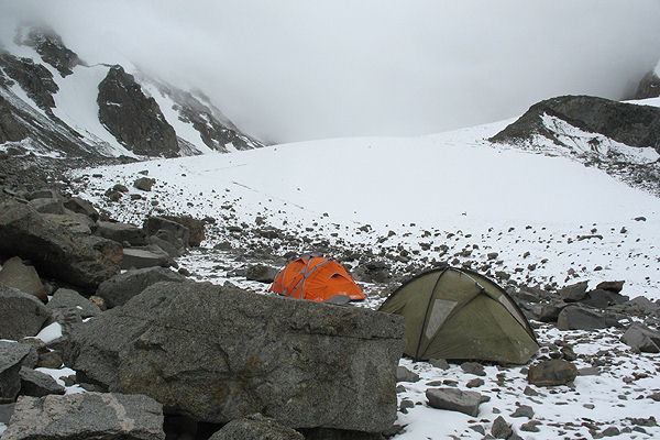
Day 6
In the morning it cleared up a little, we go to the Spartak pass, 2A.


in the background - in 4882
The pass is not avalanche-prone - the ascent passes along the buttress. And in comparison with the descriptions, this year there is little snow. The steepness is up to 40 degrees, but there is enough snow, we go without bundles, adhering to rocky outcrops.
Behind the pass is the highlight of the hike - Lake Damdzhailoo. There are 7 or 8 of them. Upper lake, below - Double.

The descent goes along the side valley to the Double Lake - straight downs. The weather turned bad - rain, fog. The group stretched out - not everyone walks confidently on wet stones. Finally, we go out to Double, find a place for tents - and, lo and behold, the sun again.

Another photo session - this time around Damdzhailoo Lake.


At the bottom of the Alai Valley and behind it is the massif of Lenin Peak.

These are the lower lakes. The saddle of our next Kekdzhar pass is visible on the left.


Day 7
The next pass - again n / a, Kekdzhar - to the valley of the same name. Broad saddle with high mountain tundra.

Descent to the Kekdzhar valley.


Gradually we approach the glacier, ...

... and then to the upper circus. The height of the overnight stay is about 4800, Skobelev Peak is in the background.

Overnight stay under Skobelev Peak (Chon-Kumtor)
Evening delighted with the sunset…


... and the morning - tolerable weather.

Day 8
Chon-Kumtor Peak (Skobelev Peak), 5051 is the highest point of the region. From the south, from the glacier (through the Sedlo Skobelev pass), the easiest way is 1B.

We leave after a light breakfast, the ascent and descent took a little over 2 hours. We pack up and run down, lunch below the glacier.
Then we go down the Kekdzhar, and then along the Kashka-su. On the way, rain caught up with us, a thunderstorm - without stopping, we run down.


Kashka-su valley, the rain has passed

bad weather over Alai valley

view of Alai valley
We camp for the night in the Kashka-su valley. In the evening, cows came to visit, very arrogant - we had to defend ourselves. Also, when staging a fashionable one-layer Mountain Hardware, the rack was broken.

Mountain Hardware and Vaude Space 3 in the Kashka-su valley.

Day 9
The exit to civilization is down the Kashka-su valley to the village of the same name.
Asian contrasts - swamp in the valley and dry slopes.


Local color.


We had lunch in the village, and surprisingly easily found transport to the MAL.


